Planning a ride and wondering where to start? The Williams Lake mountain bike trails are spread across several riding areas, with Fox Mountain the biggest. Pick an area by your skill level, then build a day around it.
| Riding area | Listed size |
|---|---|
| Fox Mountain | 93 trails, 66 km |
| South Side | 43 trails, 65 km |
| Desous | 22 trails, 49 km |
| Chimney Lake | 38 trails, 21 km |
| Chief Will Yum | 7 trails, 16 km |
These figures come from the Williams Lake Cycling Club’s Trailforks listing and can change as trails are added or retired. Check the source before you rely on them.
This guide is an independent overview. For the wider region, start with our Cariboo mountain biking guide.
How Williams Lake mountain bike trails are organised
Williams Lake sits in the central Cariboo, and its trails are grouped into named riding areas rather than one long network. Trailforks lists each area with a trail count, total descent and distance, so you can compare them before you load the car.
The listing shows five areas under the local club: Chief Will Yum, Chimney Lake, Desous, Fox Mountain and South Side. Fox Mountain has the most trails and the most distance of the five, while Desous packs the most descent into its trails.
One travel directory describes the Fox Mountain trail system as one of three popular mountain biking destinations in the region, alongside Desous Mountain and West Syde Trails. Trail names and area boundaries differ between sources, so use a current map on the day.
Fox Mountain: the core of the network
If you only have time for a single area,Fox Mountain is the obvious choice. The Trailforks listing shows 93 trails and 66 km of distance, the most of any area on the club’s list.
The ehcanadatravel.com description says the trails run along a ridge, moving from east to west, and then down the mountain. It also notes the network is designed for mountain bikers, but hikers like to explore these trails too, so ride with control and be ready to yield.
For a closer look at specific lines, see our separate guide to the Fox Mountain trails Williams Lake riders use most.
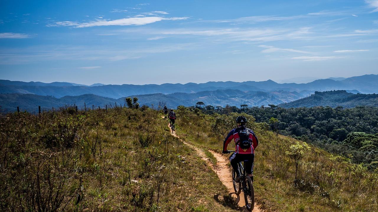
Machine-built trail work on Fox Mountain
A West Coast Traveller report dated March 8, 2021 described a Williams Lake Cycling Club project on the Fox Mountain network. It included a machine-built downhill trail and an improved uphill route.
The report said the machine-built portion would be roughly 1.5 kilometres long, while another two kilometres of existing trail would be improved. The end points were the Ross Road parking area and the Tourism Discovery Centre, chosen as the most accessible and largest parking areas on the network.
The club’s vice-president also pointed to the 2019 rebuild of the Foxfire trail as an early example of this style. In the report’s words, these trails appeal to riders “ranging from beginner to advanced”. That is a 2021 snapshot, so check the current trail map to see what was finished and how it is graded today.
The other riding areas
Beyond Fox Mountain, the club listing gives you four more places to ride. Each has a different feel, based on its numbers.
- South Side: 43 trails and 65 km of distance. It is nearly as long as Fox Mountain in distance, with fewer trails.
- Desous: 22 trails over 49 km, with the largest descent total of any area listed.
- Chimney Lake: 38 trails over 21 km, so the trails are short and numerous.
- Chief Will Yum: 7 trails over 16 km, the smallest area and an easy one to cover in a short outing.
The listing is a count of mapped trails, not a difficulty rating. Look at each trail’s grade on the map before you commit, especially if the group has mixed skills.
Reading the numbers before you choose
Trail counts and kilometres tell you how much riding an area holds, not how hard it is. A big area can still be mostly gentle, and a small one can be steep.
Total descent can be a clue to effort. Desous lists the most total descent of any area, with fewer trails and less distance than Fox Mountain or South Side, which hints at steeper, more downhill-focused riding. Treat that as a starting point, not a grade.
Here is a simple way to match an area to your day:
- Short outing: Chief Will Yum, the smallest area listed, suits a quick loop or a first look.
- Full day on varied trails: Fox Mountain gives the widest choice, so you can change plans mid-ride.
- Long distance: South Side lists distance close to Fox Mountain, which suits riders who want to cover ground.
- Steeper descending: Desous has the largest descent total, so check trail grades first.
The ehcanadatravel.com Fox Mountain page is a general directory entry, so use it for background rather than live conditions.
Who looks after the trails
The Williams Lake Cycling Club is listed as the trail association for these areas. Its Trailforks page shows supported or adopted trails including GILF, Fox Mountain, Chief Will-Yum XC and Russet Bluff.
The listing describes work done through mutual cooperation between club, government, industry and other land users, following current best practice standards. It also invites riders to buy a trail membership to support the club.
Adopted trails are the ones a group has agreed to look after, which usually means regular brushing, drainage fixes and signage. Riders who want to give back can start with a membership, a donation or simply by reporting damage.
That is useful context for anyone riding here: much of the network exists because of volunteer and club effort. Stay on marked trails, avoid riding when the surface is soft, and treat any trail closure as final.
Planning your visit
Use a short checklist to turn the trail numbers into a plan.
- Choose an area that matches your fitness and skills, starting with Fox Mountain if you are unsure.
- Open a current trail map and check conditions and any closures.
- Pack water, repair kit and layers, since you may be some distance from town on a ridge.
- Expect hikers on shared trails and slow down at blind corners.
- Consider supporting the club through a trail membership or donation.
- Tell someone your route and expected return time before you head out.
If you are weighing Williams Lake against other regions, our overview of mountain bike trails British Columbia offers a wider comparison. The directory pages used here were not all dated, so confirm anything time-sensitive locally.
Frequently asked questions
Which area has the most trails?
Show answer
Fox Mountain, with 93 trails and 66 km listed on the Williams Lake Cycling Club’s Trailforks page.
Which area has the most descent?
Show answer
Desous, which has the largest total descent among the five areas on the same listing, across 22 trails.
Will I share the trails with hikers?
Show answer
Yes, possibly. The ehcanadatravel.com description of Fox Mountain says hikers like to explore these trails too.
Who maintains the trails?
Show answer
The Williams Lake Cycling Club is the listed trail association, and its Trailforks page invites riders to buy a trail membership.