
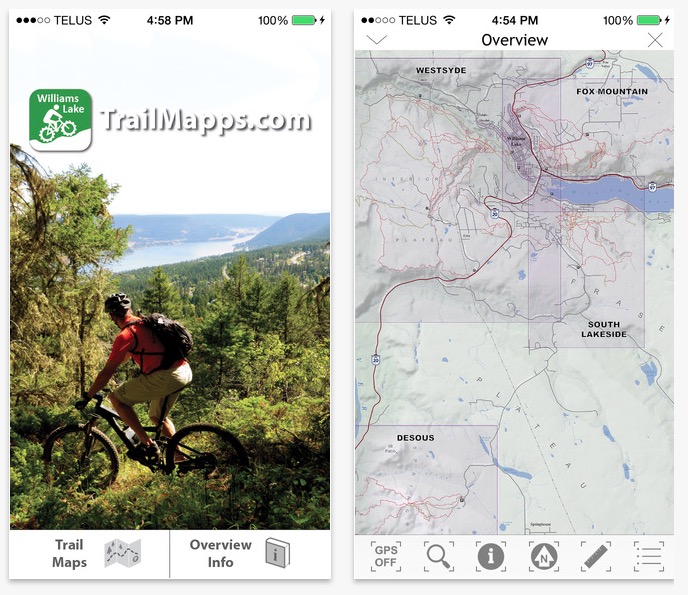
Ride in the heart of Cariboo Country!
Find and ride over 100 named trails in the Williams Lake area.
This app is a collaborative effort between the Williams Lake Cycling Club and TrailMapps.com; proceeds from the sale of this app go towards trail maintenance and enhancement.
Featuring:
-overview map interface showing all of the riding areas
-custom large scale topographic maps of the trail networks for Desous Mountain, Fox Mountain, South Lakeside, and Westsyde trails
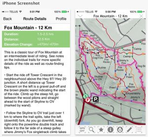
-descriptions and difficulty ratings for all trails
-info buttons along each trail open the trail description page and can be toggled on and off
-suggested route overlays to help take the guesswork out of how best to enjoy the trails
-location icon which accurately displays your position on the map
-compass tool to assist with orienting the map to your surroundings
-auto pan and zoom maps to selected trails
-dynamic scale bars to help you judge the distance of trails on the maps
-directions to parking areas for common trail access points (simply tap a parking symbol on the map)
-no cellular data required; works without a cell signal or Wi-Fi, once the app is downloaded you’ll have full access to all maps even without cell reception
https://itunes.apple.com/ca/app/trailmapps-williams-lake/id1029691441?mt=8
Thomas Schoen